

1 / 3
Details
About this product
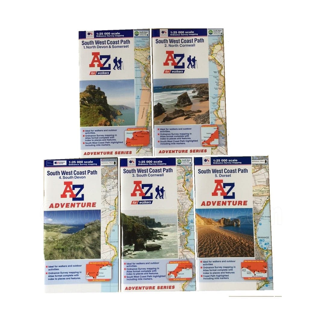
The A-Z Adventure series puts Ordnance Survey's most detailed mapping, OS Explorer at 1:25,000, into a book, so there's no folding and refolding a large sheet map. Closed, each atlas is the size of a standard OS Explorer map.
An index lists towns, villages, natural features, car parks and youth hostels, each with a page and a six-figure grid reference. A route planner gives distances and amenities along the way, from campsites to cafes, and QR codes link to useful websites.
Five books cover all 630 miles of the path, from Minehead to Poole Harbour, so you choose the stretch you need.
No unfoldingTurn the page instead of wrestling with a large map in the wind.
Find places fastThe index gives a page and grid reference for every entry.
Plan the dayThe route planner shows distances and where to find food, beds and supplies.
Specifications
The details
Product typeWalking atlas
FormatBook, 36 to 50 pages of mapping depending on the stretch
SeriesA-Z Adventure
MappingOrdnance Survey Explorer
Scale1:25,000 (4cm to 1km, 2.5 inches to 1 mile)
Size134 x 240 x 8mm
StretchesNorth Devon & Somerset, North Cornwall, South Cornwall, South Devon, Dorset
IndexPlaces and features, with page and six-figure grid references
Worked well
Good little activity for a quiet afternoon.Could be better
I wanted a book to work better, especially around the family use. It was not a disaster, but I would not rush to recommend it.Excellent
Really pleased with it.Excellent
The book is useful and good value, with one small thing I would tweak.Used it straight away
Better than expected.Every review is shown, low scores included. The breakdown chart appears from 10 reviews.
FAQs
Questions before you buy
Which book covers my walk?
North Devon & Somerset runs from Minehead to Bude, North Cornwall from the Devon border to Land's End, South Cornwall from Land's End to Plymouth, South Devon from Plymouth to Lyme Regis, and Dorset from Lyme Regis to South Haven Point in Poole Harbour.
How much mapping is in each book?
North Devon & Somerset and Dorset have 36 pages of mapping each, North Cornwall 41, South Cornwall 50 and South Devon 40. The Dorset book also shows the shorter South Dorset Ridgeway route.
Still deciding?
Message our team
We are a small family-run shop. Ask us anything before you order.
Send us a message support@downthecove.comDelivery and returns
Before you order
Packed and posted by our own small team.
Tracked 48£3.50Free over £30Usually 2–3 working days
Tracked 24£4.50Free with Cove ClubAims for the next working day
Returns30 daysFree in the UKUnused and complete; start it from your order
Order by 3pm on a working day and it usually leaves the same day. Remote Scottish areas and the Isles of Scilly £14.95 · Europe £15 · rest of the world £25.DeliveryReturnsTrack an order
For the coast path
Walks and guides
 Est. 2012
Down The Cove · founded in Cornwall, 2012
A small family-run shop with Cornish roots
- Order by 3pm on a working day and we usually dispatch the same day
- Questions answered by our own small team
- Cove Club members get free delivery and member discounts
- We donate 1% of all profits to Compassion UK
We donate 1% of all profits to Compassion UK, supporting its work with children and communities facing poverty: clean water, healthcare and education. Compassion UK is an independent charity. Visit Compassion UK